Sudan
Introduction
Sudan is located between a latitude between 8.7 °N and 23.1 °N. The total land area is about 2 million km2. The country is administratively subdivided into 18 Wilayat (States), and these are further sub-divided into 80 District .

Administrative Divisons Map
The states of Sudan
Human development
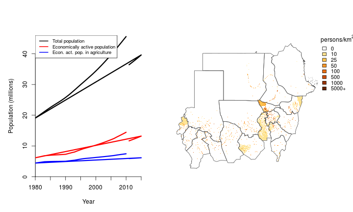
Population
Sudan has about 39.6 million inhabitants. The population has increased 1.8 fold over the past 30 years. The economically active population is 13.2 million, 47% of which is employed in agriculture (down from71% in 1985). The rural population was 80% in 1985 and now it is 70%.
Development
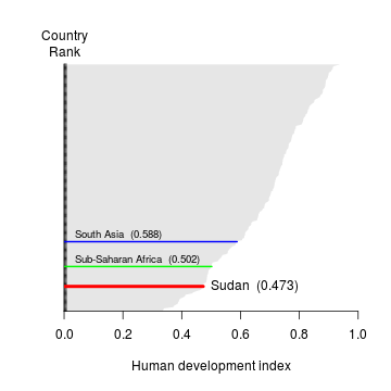
Human Development Index ranking and value
Human Development Index ranking for Sudan. Data source: UNDP.
Gender
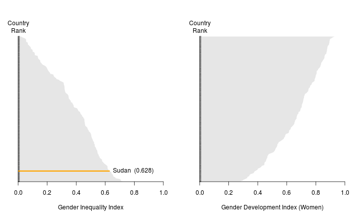
Gender Inequality and Development Indexes
Gender Inequality and Development Indices for Sudan. Data source: UNDP.
Health and nutrition
## Error in plot.window(...): need finite 'xlim' values

Child height-for-age Z-score and women’s body mass index
Average height-for-age Z-score for children (a child with a score less than -2 is considered stunted), and body mass index for women. Data source: DHS.
Micronutrients
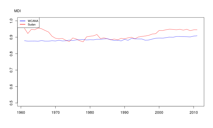
MicroNutruent Density Index
Micronutrient Density Index (MDI) between 1961 and 2011. Source: Beal et al.

Prevalence of Inadequate Nutrient Intake
Estimated prevalence of inadequate intake (%) of micronutrients between 1961 and 2011. Source: Beal et al.
Land and water resources
Elevation
The elevation of Sudan is between 0 and 2910 meters above sea level. Half the land area is below 490 meter and in between 410 and 610 meter.

Climate
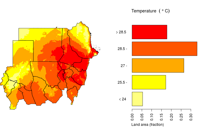
The annual average temperature in Sudan is between 14.5 and 30.4 °C. The median annual average temperature is 27 °C and half the land area has an annual average temperature between 25.6 and 28 °C. For more details see the monthly temperature maps. For projected future climate change, see these maps.
data source: WorldClim
Average annual mean temperature (°C) for 1950-2000 in Sudan. Source WorldClim
The annual total precipitation in Sudan is between 0 and 1180 mm. The median is 130 mm and half the land area has an annual total precipitation between 30 and 390 mm. For more details see the monthly precipitation maps. For projected future climate change, see these maps.

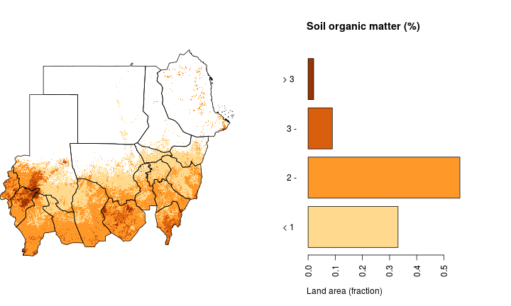
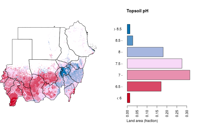
Soils
Water
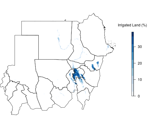
Map of Irrigated Agricultural Land
Percentage of agricultural land that is irrigated. Data source: GMIA
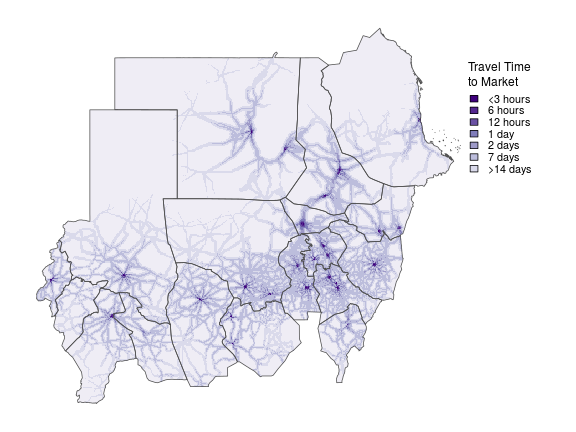
Land tenure
Food production
Crop production

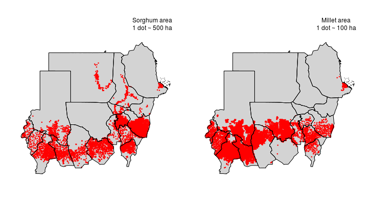
Cultivation Distribution
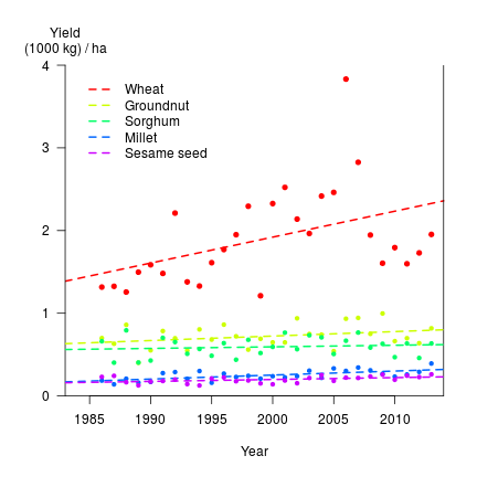
Annual linear growth rates of crop yield over the past 30 years, for the main five crops , were between 1.9 (Sorghum) and 31.4 (Wheat) kg/ha
Livestock
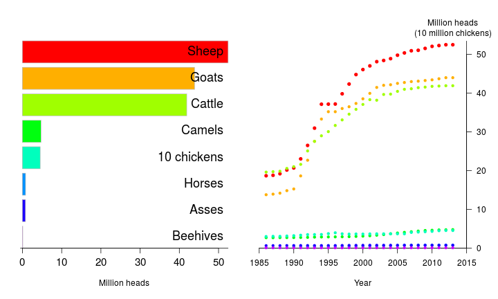
Livestock Distribution
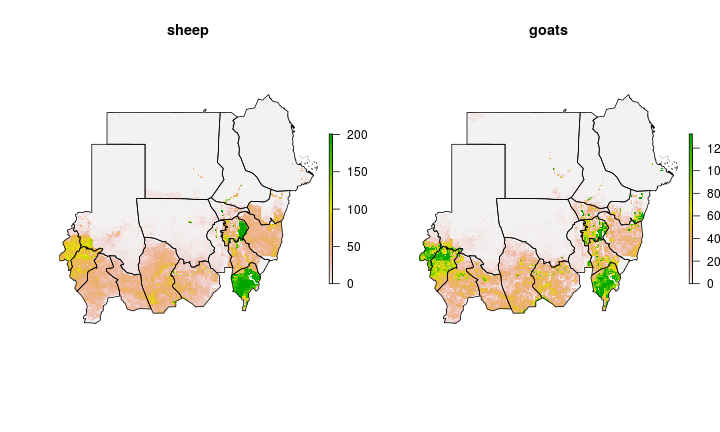
Spatial distribution (head per km2) of sheep and goats in Sudan. Data source: Gridded Livestock of the World. More livestock maps.


Intensification

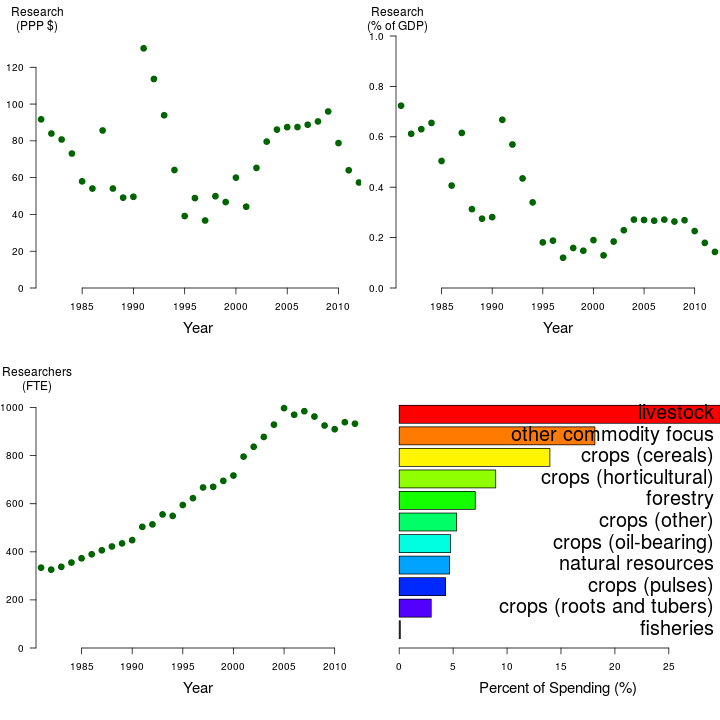
Investment in Agricultural Research
Investment in Agricultural Research over time and by commodity groups ( data source: ASTI).
Yield gaps

Yield Gap
Yield Gap (1000 kg / ha).

Selected research and development priorities and projects
Nature conservation
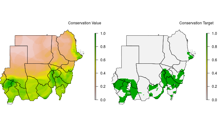
Conservation Priorities
Conservation Priorities.
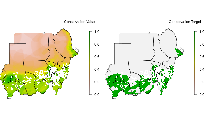
Conservation Priorities excluding Urban and Agricultural land
Conservation Priorities excluding Urban and Agricultural land.